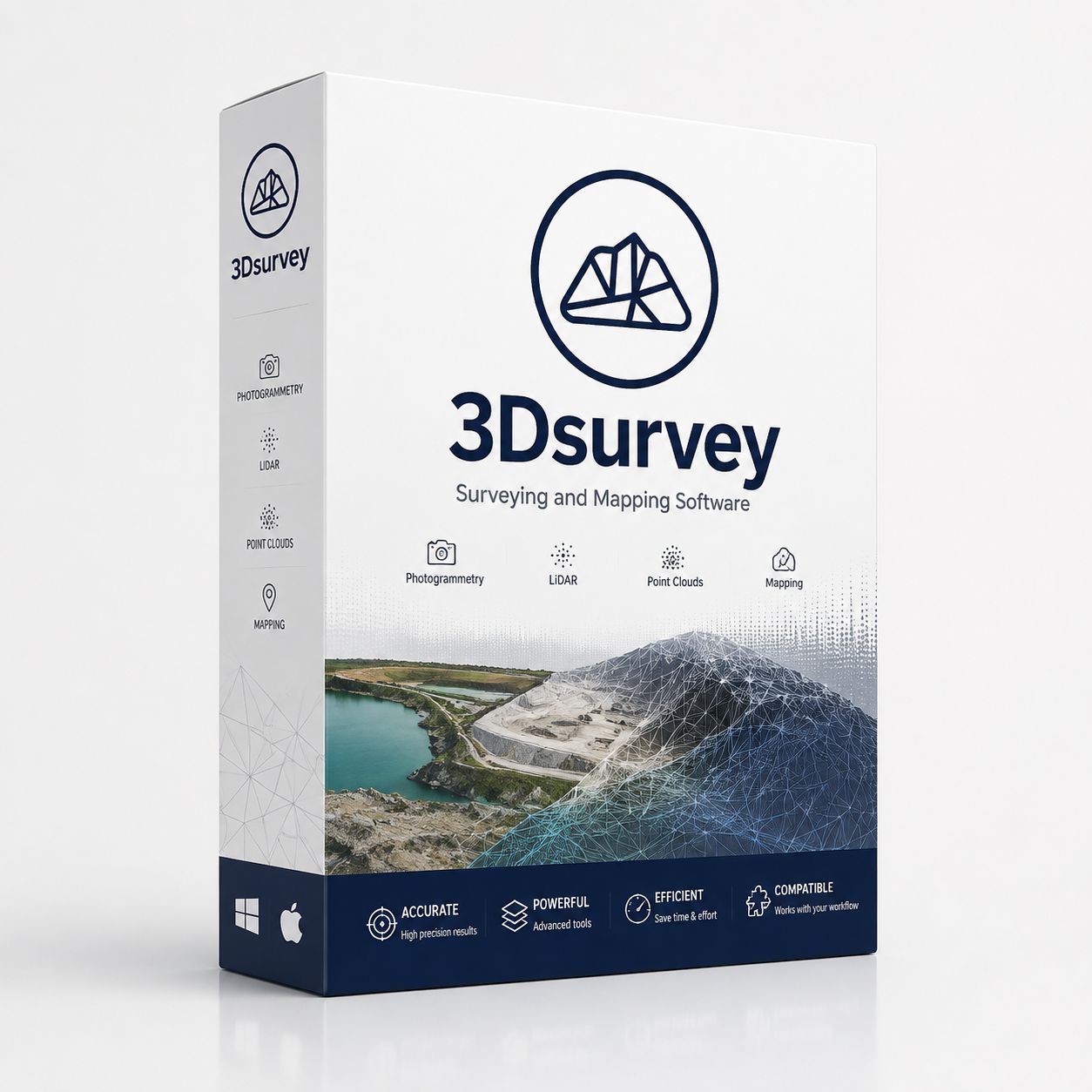
3Dsurvey
€170
Professional Surveying and Photogrammetry Software
In stock
Save this product for later
3Dsurvey
Product Details
3Dsurvey for Windows - Professional Surveying and Photogrammetry Software with Perpetual License
3Dsurvey v4, v3 and v2
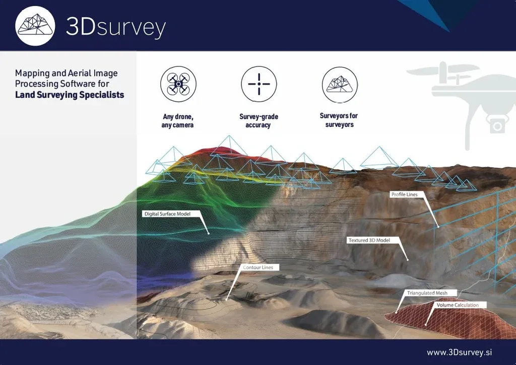
3Dsurvey Software
Process and classify any data source for any environment.
Process and classify any data source for any environment.
Our all-in-one photogrammetry tool gives you everything you need to know about a site, whether it’s a brownfield site, a new building, a quarry, a mine or a natural disaster. It gives you this information in digital maps, 3D models and interactive measurements that you can easily explore. 3Dsurvey is a comprehensive photogrammetry software solution with the capability to process and classify data from any input. Created with the practical needs of surveyors in mind, it is an agile and versatile tool, useful for many different industries.
Description
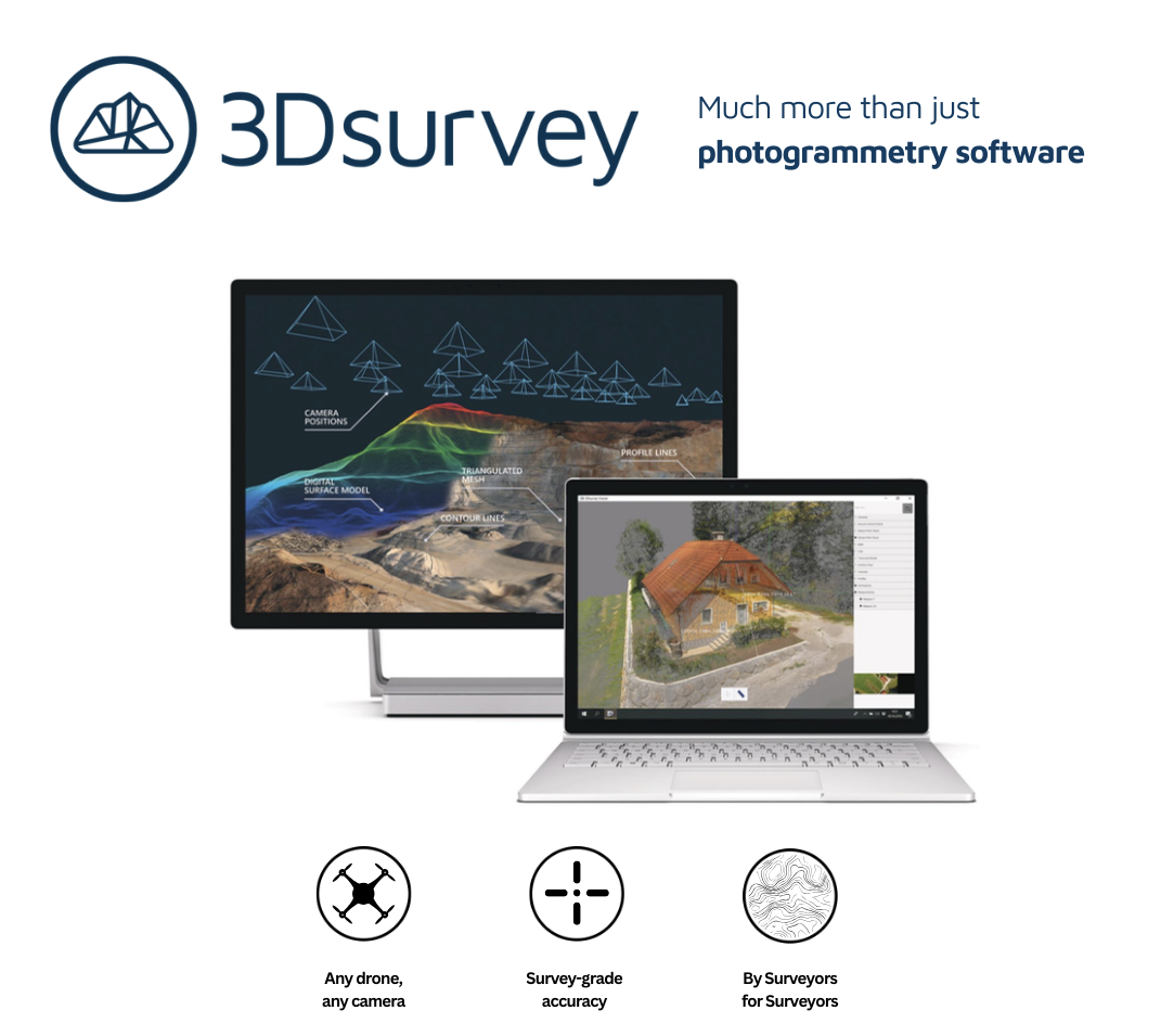
Armed with cm-grade precision digital maps and 3D models, professionals in industries spanning surveying, mining, construction, quarrying and natural disaster management can make more informed plans and responses. Created by experienced surveyors, our reliable and intuitive tools help businesses worldwide reduce time spent on site, improve planning accuracy and boost revenue. Our best-in-class customer service ensures that no customer is left behind. We treat you like a real person, not just another number. With direct access to the technical team, we can quickly resolve any potential issues – so you can get back to your passion.
Armed with cm-grade precision digital maps and 3D models, professionals in industries spanning surveying, mining, construction, quarrying and natural disaster management can make more informed plans and responses. Created by experienced surveyors, our reliable and intuitive tools help businesses worldwide reduce time spent on site, improve planning accuracy and boost revenue. Our best-in-class customer service ensures that no customer is left behind. We treat you like a real person, not just another number. With direct access to the technical team, we can quickly resolve any potential issues – so you can get back to your passion.
GIVING YOU CONTROL
If a picture tells you a thousand words, then 3D data that’s fully geo-referenced, spatially orientated and has cm-grade precision tells you millions.
Our all-in-one photogrammetry tool gives you everything you need to know about a site – whether it’s a brownfield site, a new building, a quarry, a mine or a natural disaster. It gives you this information in digital maps, 3D models and interactive measurements that you can easily explore. With 3Dsurvey, the possibilities are endless. What makes our software different from others in the market is that it does all these things consistently and with more precision. We don’t just provide information from any data source; our software turns your data into countless opportunities. From helping you discover, process and manipulate data – we give you more accuracy whilst increasing your revenue potential.
Because when there are fewer surprises, you are in control.
If a picture tells you a thousand words, then 3D data that’s fully geo-referenced, spatially orientated and has cm-grade precision tells you millions.
Our all-in-one photogrammetry tool gives you everything you need to know about a site – whether it’s a brownfield site, a new building, a quarry, a mine or a natural disaster. It gives you this information in digital maps, 3D models and interactive measurements that you can easily explore. With 3Dsurvey, the possibilities are endless. What makes our software different from others in the market is that it does all these things consistently and with more precision. We don’t just provide information from any data source; our software turns your data into countless opportunities. From helping you discover, process and manipulate data – we give you more accuracy whilst increasing your revenue potential.
Because when there are fewer surprises, you are in control.
SAVING YOU TIME
Capture, download & process.
As an end-to-end solution, our software gives you the power to process data from any input – this means less manual work and more time planning and implementing. It transforms equipment into automated high-precision surveying tools. No add-ons required. No need to change your data source.
Ultimately, having this kind of accurate, real-time information readily accessible means you can cut down on-field time and manual work. Our easy to use software is the only solution on the market that mirrors industry workflows. Drawing on our first-hand surveying experience, we’ve built the tools to support how you get things done in the real world. It’s fast, intuitive and easy to use.
Capture, download & process.
As an end-to-end solution, our software gives you the power to process data from any input – this means less manual work and more time planning and implementing. It transforms equipment into automated high-precision surveying tools. No add-ons required. No need to change your data source.
Ultimately, having this kind of accurate, real-time information readily accessible means you can cut down on-field time and manual work. Our easy to use software is the only solution on the market that mirrors industry workflows. Drawing on our first-hand surveying experience, we’ve built the tools to support how you get things done in the real world. It’s fast, intuitive and easy to use.
AND DOING IT WITH KNOW-HOW
Like you, we’re a team of specialists passionate about our craft. We get excited by the endless possibilities of our geospatial software and how new technologies can improve our solutions for you.
Before developing 3Dsurvey, most of us were in the traditional surveying field. This remains true today – we know what makes our clients’ lives easier. We’re constantly evolving our software, which means developing it to better support you on and off-site.
Like our software, we’re reliable and consistent. Our unbeatable customer support team is always on hand to help and, importantly, to listen.
Like you, we’re a team of specialists passionate about our craft. We get excited by the endless possibilities of our geospatial software and how new technologies can improve our solutions for you.
Before developing 3Dsurvey, most of us were in the traditional surveying field. This remains true today – we know what makes our clients’ lives easier. We’re constantly evolving our software, which means developing it to better support you on and off-site.
Like our software, we’re reliable and consistent. Our unbeatable customer support team is always on hand to help and, importantly, to listen.
Capture, Process, Extract, Share
With 3Dsurvey, you can create high quality 3D models, maps and detailed reports with unmatched precision and ease.
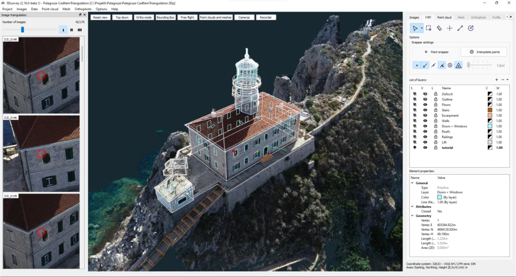
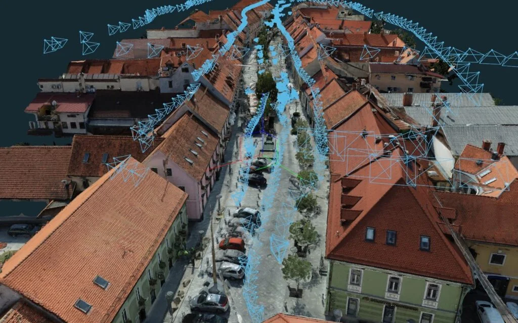
Compatible with the equipment you use
Our system is compatible with any drone, camera, GNSS, LiDAR, SONAR, geospatial data, real-time telemetry, and offers a free mobile pilot app, supporting jpg, png, tiff, mp4, mov, avi file formats.
Different tools enable you to extract and create the information you need, from volume calculation to drawing profile lines.
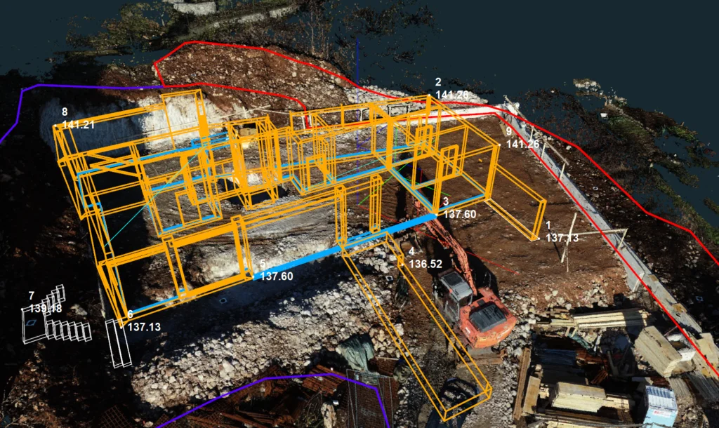
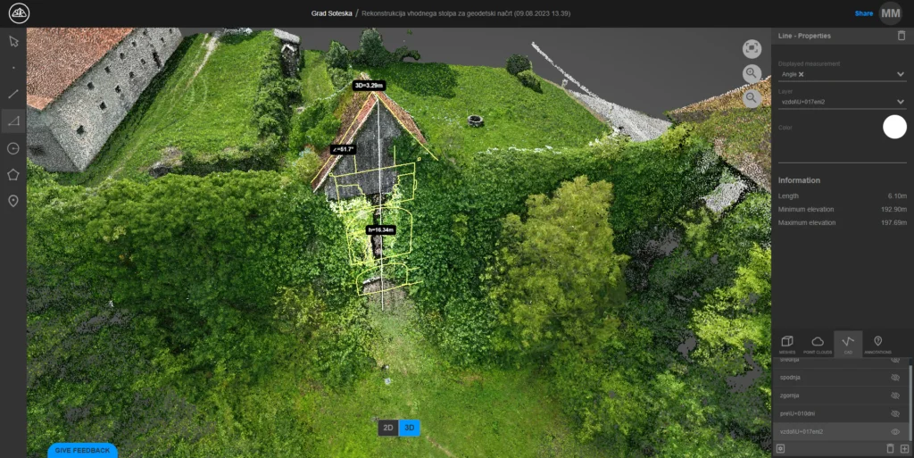
3Dsurvey Cloud for easy sharing
Simply share a link and let your client access your uploaded results from any device.
For specific needs, take advantage of our Scan and RTK Videogrammetry solutions
Your purchase will be available for download immediately after payment is received. Updates will always be accessible in your account.
DKSoft.shop©
Display prices in:EUR