Precisely MapInfo Professional
€150
In stock
Save this product for later
Precisely MapInfo Professional
Product Details
Precisely MapInfo Professional for Windows - Professional GIS Mapping and Location Intelligence Software with Perpetual License & Unlimited use and map, Drives
MapInfo Pro v2023
Unlock the next dimension in spatial analytics with the powerful, easy-to-use GIS you expect.
Location data adds both insight and complexity to corporate decision-making. Mistakes are too expensive for a trial-and-error approach to mapping. For example, if you’ve opened a new fast-food restaurant, you can’t relocate it once you realize you made a poor decision and you’re not drawing the crowds you need.
MapInfo Pro is an easy-to-use geographic information system (GIS) that helps you more easily capture, manage, analyze,
and visualize location data — revealing relationships, patterns, and trends.
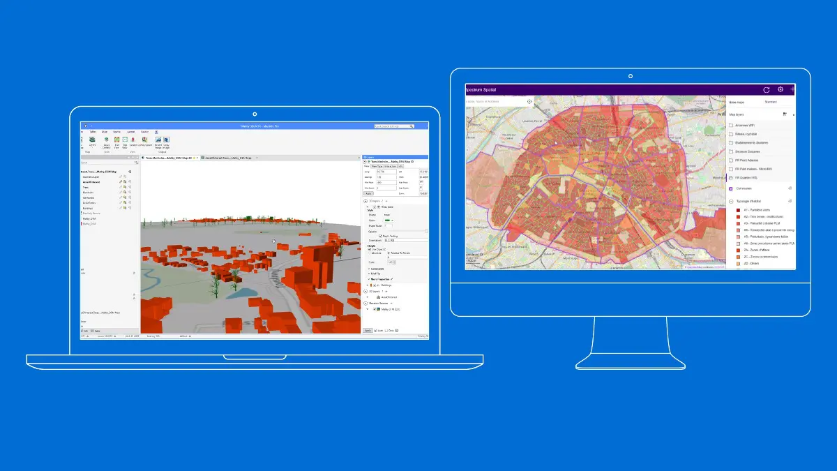
The latest addition of 3D visualization in MapInfo Pro v2023 offers an engaging way to convey complex spatial context to a broader audience and unlocks endless possibilities for urban planning, coastal modeling, and disaster management. Share business-critical findings with different teams and departments to enable quick access to location-based context across
Use MapInfo Pro to explore, model, and act upon the world around you.
Explore
Better understand a location by gathering information about its key features and how they interact. Visualize data through map symbols, themes, and labels. You can even overlay multiple datasets on a single map to distinguish patterns
that would otherwise be hidden.
Model
Integrate your corporate data with maps and demographics by turning addresses into locations. Combine this information with our powerful spatial querying and modeling tools. Run different scenarios for an accurate, up-to-date representation
of a location’s possibilities.
Confidently explore, model, and act
Location data adds both insight and complexity to corporate decision making. Mistakes are too expensive for a trial-and-error approach to mapping. If you’ve opened a new shopping mall, you can’t relocate it once you realize your location intelligence was bad and you’re not drawing the crowds you need.
MapInfo Pro GIS software employs geospatial analytics and location intelligence to help you create insightful models of location-centric scenarios. Use these models to simulate different outcomes — then act with confidence. Use MapInfo Pro to:
Bring a new dimension to your spatial data
We live in a 3D world, so visualizing three-dimensional spatial data provides a more comprehensive and realistic representation of terrain, buildings, and objects.
Some applications – like disaster management, coastal modeling, and urban planning – will rely entirely on your ability to create realistic digital representations. And 3D visualizations offer a more intuitive and immersive view of geospatial information, making it more accessible for non-GIS teams.
With MapInfo Pro, you can easily visualize your 3D data using OpenGL rendering without additional tools or extensions. Quickly display data in 2D and 3D simultaneously to reveal patterns and relationships not seen in traditional visualization, then share your findings with broader teams for greater impact.
Description
MapInfo Professional is a powerful Microsoft® Windows®-based mapping and geographic analysis application from the experts in location intelligence. Designed to easily visualize the relationships between data and geography, MapInfo Professional helps business analysts, planners, GIS professionals – even non-GIS users – gain new insights into their markets, share information-rich maps and graphs and improve strategic decision-making.
See your business data in powerful new ways
• Discover trends hidden in spreadsheets and charts
• Gain new understanding of your customers and markets
• Perform powerful data analysis and calculations
• Create custom maps and content for analysis
Use geographic insights to innovate business processes
• Manage location-based assets, people and property
• Optimize service and sales territories for greater efficiencies
• Deploy networks, infrastructure and utilities with confidence
• Map resources, plan logistics and prepare for emergencies
Works and plays well with existing IT infrastructure
• Designed and tested with Windows operating systems
• Imports and exports data in a wide variety of formats
• Easily customized to meet your specific needs
Extract information from raster data
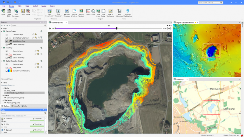
Creating optimum insights from large spatial files can be a significant challenge. Use our patented Multi-Resolution Raster (MRR) data format for powerful spatial processing and map rendering. Identify, quantify, and visualize spatial patterns in raster datasets of practically unlimited size. Or use our Multi-Resolution Virtual Raster (MVR) to virtually merge, reproject, and resample raster grid data on-the-fly, without writing out new grid files to disk.
Your purchase is provided as download immediately after payment is received
DKSoft.shop©
Display prices in:EUR